


Voting District 0001, Jackson County, Texas
About
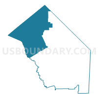
Outline

Summary
| Unique Area Identifier | 674959 |
| Name | Voting District 0001 |
| County | Jackson County |
| State | Texas |
| Area (square miles) | 228.10 |
| Land Area (square miles) | 228.02 |
| Water Area (square miles) | 0.08 |
| % of Land Area | 99.96 |
| % of Water Area | 0.04 |
| Latitude of the Internal Point | 29.09844980 |
| Longtitude of the Internal Point | -96.76478450 |
Maps


Graphs
Select a template below for downloading or customizing gragh for Voting District 0001, Jackson County, Texas


Neighbors
Neighoring Voting District (by Name) Neighboring Voting District on the Map
- Voting District 0002, Jackson County, TX
- Voting District 0003, Jackson County, TX
- Voting District 0006, Jackson County, TX
- Voting District 0011, Victoria County, TX
- Voting District 0016, Lavaca County, TX
- Voting District 0020, Lavaca County, TX
- Voting District 0027, Victoria County, TX
- Voting District 0103, Colorado County, TX
- Voting District 0303, Wharton County, TX
Top 10 Neighboring County Subdivision (by Population) Neighboring County Subdivision on the Map
- Victoria CCD, Victoria County, TX (70,435)
- Edna-Cordele CCD, Jackson County, TX (7,508)
- Hallettsville CCD, Lavaca County, TX (6,975)
- Yoakum CCD, Lavaca County, TX (6,134)
- Louise CCD, Wharton County, TX (2,500)
- Garwood CCD, Colorado County, TX (2,162)
- Vanderbilt CCD, Jackson County, TX (1,225)
Top 10 Neighboring Place (by Population) Neighboring Place on the Map
Top 10 Neighboring Unified School District (by Population) Neighboring Unified School District on the Map
- Victoria Independent School District, TX (79,038)
- El Campo Independent School District, TX (17,808)
- Edna Independent School District, TX (7,840)
- Hallettsville Independent School District, TX (6,840)
- Industrial Independent School District, TX (4,153)
- Ezzell Independent School District, TX (727)
Top 10 Neighboring State Legislative District Lower Chamber (by Population) Neighboring State Legislative District Lower Chamber on the Map
- State House District 28, TX (263,682)
- State House District 17, TX (166,171)
- State House District 30, TX (147,611)
Top 10 Neighboring State Legislative District Upper Chamber (by Population) Neighboring State Legislative District Upper Chamber on the Map
Top 10 Neighboring 111th Congressional District (by Population) Neighboring 111th Congressional District on the Map
Top 10 Neighboring Census Tract (by Population) Neighboring Census Tract on the Map
- Census Tract 16.06, Victoria County, TX (7,563)
- Census Tract 9503, Jackson County, TX (4,829)
- Census Tract 9502, Jackson County, TX (3,904)
- Census Tract 1, Lavaca County, TX (3,431)
- Census Tract 5, Lavaca County, TX (3,330)
- Census Tract 7411, Wharton County, TX (2,500)
- Census Tract 7502, Colorado County, TX (2,162)
Top 10 Neighboring 5-Digit ZIP Code Tabulation Area (by Population) Neighboring 5-Digit ZIP Code Tabulation Area on the Map
- 77995, TX (9,567)
- 77957, TX (8,187)
- 77964, TX (7,569)
- 77962, TX (3,286)
- 77968, TX (2,774)
- 77455, TX (2,045)
- 77442, TX (1,137)